-->
LATEST HEADLINES
66th REPUBLIC DAY WISHES TO ALL INDIANSZizix Tutorials
LATEST POSTS TIME OF NOW
Showing posts with label ECOLOGY RESEARCH. Show all posts

Deep Sea Mining: What are the risks?

During the launch event in Kiel, the project partners plan investigations to ecosystems around the manganese nodules. Photo: J. Steffen, GEOMAR

GEOMAR coordinates European cooperation for the risk assessment
01.29.2015 / Kiel. 50 specialists in deep-sea ecology, marine mining and deep-sea observation of 25 European research institutions meeting this week at the GEOMAR Helmholtz Centre for Ocean Research Kiel. This will free the start of a three-year research project to investigate the risks of potential ore mining on the seabed. The project called "JPI Oceans Ecological aspects of deep-sea mining" is coordinated at GEOMAR.

The world population is growing. This also means that more and more people need a home, want to work with computers and other electronic devices and consume energy. For the construction of houses for the manufacture of electronic goods, but also for the production of wind turbines will require significant amounts of various metals. Currently, all metal ores are promoted on almost a third of the earth's surface - on the continents. 
In some regions of the ocean manganese nodules are recorded in the Atlantic as here, close together on the ocean floors. Photo: Nils Brenke, CeNak

However, in recent decades engaged again, the other two thirds, the oceans, the focus of governments and resource companies. "Many questions about a potential ore mining in the deep sea, however, are still open," says Dr. Matthias Haeckel from GEOMAR Helmholtz Centre for Ocean Research Kiel. He is the scientific coordinator of the "Ecological aspects of deep-sea mining" project to investigate the potential environmental risks in the next three years. A consortium of research ministries in eleven European countries promotes it as part of the Joint Programme Healthy and Productive Seas (JPI Oceans) initiative with a total of 9.5 million euros. 
In the Clarion-Clipperton Zone are the largest known manganese nodule deposits. Here, the ISA has been awarded 13 research licenses. Image Reproduced from the GEBCO world map 2014 www.gebco.net,
 In the Clarion-Clipperton Zone are the largest known manganese nodule deposits. Here, the ISA has been awarded 13 research licenses. Image Reproduced from the GEBCO world map 2014

This week, the project starts with a kick-off meeting at GEOMAR. A total of 25 partner institutions from these eleven countries involved in the project. The focus is primarily known as manganese nodules. It is spherical or cauliflower-shaped Erzknollen, which are usually at depths below 4000 meters on the large abyssal plains. They consist not only from the eponymous manganese, but also contain iron and coveted metals such as copper, cobalt or nickel. Already in the 1970s, there were initial plans to reduce manganese nodules from the deep sea, but never came out on trials. The largest reserves are currently known from the Clarion-Clipperton Fracture Zone in the central Pacific. As a result of these activities in international waters on the basis of the International Law of the Sea (UNCLOS), the International Seabed Authority (International Seabed Authority, ISA) was founded in 1994. 

It manages the entire seabed beyond the exclusive economic zone (200 nautical miles) of individual states. To date, the ISA has awarded 13 research licenses for exploration of manganese nodule fields in the Pacific, including in Germany and other European countries. 
Sample of the seabed in DISCOL area with top resting manganese nodules.
                     Sample of the seabed in DISCOL area with top resting manganese nodules. 
                                                    Photo: M. Haeckel, GEOMAR

"But there is no mining licenses, which would only be a next step," said Dr. Haeckel. Since the ISA also aims to ensure effective protection of the marine environment from the potential consequences of ocean mining, relevant research for the licensees are required. "Of course industrial activities on the ocean floor will have an impact, because they disturb the soil and the water column about it," says Dr. Haeckel. Therefore, it is important to know the ecosystems on the sea floor and its local, regional and national connections and interactions accurately. Already this year, several expeditions of the new German research vessel SONNE in the Pacific are planned. 

The first trips in March and April perform the participating scientists to the German, Belgian and French license areas and in a defined by the ISA reserve in the Clarion-Clipperton Zone. Further trips from July to October have the so-called DISCOL area in Peru Basin to the destination. There, in 1989, a very limited area of the seabed was plowed for research purposes. "The goal of this experiment is to recognize the long-term consequences of large-area device used for deep-sea sediments," explains Professor Jens Greinert from GEOMAR, who will lead one of the exits to DISCOL area. Now, a quarter century after the disturbance experiment, the scientists will examine the then machined seabed areas exactly compare with adjacent undisturbed areas to determine, can recover disturbed communities in the deep sea as fast. "We should get to know each other better before we start, a large area to intervene in the deep sea it easy," says project coordinator Dr. Haeckel. 

Source: GEOMAR

Satellites for peat sake - Peatlands play vital role in curbing climate change

                         Peatlands play vital role in curbing climate change Credit: JHU
Peatlands make up just 3% of land but capture twice as much carbon as all forests combined.

They are also an important source of drinking water and provide a home to many rare and threatened animals and plants.

Ecosystems work best when left intact but these wetland areas are being threatened by human exploitation, resulting in vast carbon emissions, frequent and uncontrollable fires and loss of valuable landscapes.
                                            Handheld devices for collecting ground data

Rezatec in Oxfordshire, UK, supported by ESA’s Integrated Applications Promotions programme, in the Peat spotter project will give landowners an easier and cheaper way of calculating the potential economic value of conserving or restoring their peatlands and monitoring the results of their investment.

“Peat spotter helps landowners to manage their peat resource more sustainably through mapping the area, measuring the carbon it contains and monitoring how its integrity is changing over time,” says Patrick Newton, CEO of Rezatec.

To do this, satellite imagery is used to locate and create initial mappings of peatlands. This information is enriched with ground data collected by field agents using handheld devices.

An app prompts users in the field for measurements, satnav adds location information, and the data are then sent directly to a centralised office via satcom for analysis.

The new approach is a cost-effective way of measuring peat extent and how intact it is over wide and potentially remote areas that are otherwise expensive to measure or inaccessible from the ground.

Rezatec expects water companies, conservation groups and those using typically state-owned land for uses such as plantations to sign up for this service.

Peatlands are an important source of drinking water. Water companies using these resources can significantly reduce the water treatment necessary to meet drinking water standards if they are able to identify areas of degraded peatland and make restoration efforts at source.

Water derived from degraded peatlands can contain raised levels of dissolved organic carbon causing significant discolouration.

On land that is typically used for plantations, peat assets are included in the measurement of the greenhouse gas balance, but only through a rough calculation.

                                                     Deforestation damages peatlands

Making it cheaper and easier to locate and monitor peatlands will make it simpler to calculate the economic value of conserving and restoring these areas and, in turn, this can be positive for society, the economy and the environment.

Within the mobile device apps Rezatec includes: guides to help identify flora and fauna, videocam monitoring of borders, photo uploading, alerts when levels are breached, and fire mapping.

“This innovative use of satellite data has far-reaching benefits for the space industry and the wider UK economy,” notes Alan Brunstrom, head of the Service Business Office in ESA’s Integrated Applications Promotion programme.

“Perhaps more importantly, it demonstrates how the scientific analysis of ‘big data’ can benefit the environment and, in this particular scenario, provide valuable information to allow sustainable peatland management practices on a global scale.”

Source: JHU

Blue mussels not yet the bellwether of NE coastal environment

Marcy Cockrell installs cages to protect mussels from predators. In Maine, mussels inside cages faired as well as mussels in the wild. In Long Island Sound and Narragansett Bay it was a different story. Credit: Brown University

Ecologists sometimes look to mussel species, a well-studied and foundational genus in estuaries, as model organisms for assessing the condition of coastal habitats, which are crucial for people and well as the broader environment.

But a new study in the journal Ecosphere suggests that the seemingly simple blue mussel, when studied on regional scale from Maine to Connecticut, harbors at least three specific mysteries that must be solved if the mollusks are to serve as the "canaries in the coal mine" of the Northeast coast.

"Mussels could indeed be a good sentinel species for rocky shores, but what our work suggests is that we need to know a lot more about how they behave in these different estuarine settings to use them as an indicator of ecosystem health," said conservation scientist and study senior author Heather Leslie, the Peggy and Henry D. Sharpe Assistant Professor of Environmental Studies.

For the study, Leslie and former students Marcy Cockrell and Joanna Bernhardt monitored and experimented with mussels at 18 sites in the Casco Bay of Maine, the Narragansett Bay of Rhode Island, and the Long Island Sound of Connecticut and New York in 2010 and 2011 (a region spanning about 600 kilometers of coastline). They measured the abundance of mussels both at adult and larval stages, studied the populations of neighboring rocky shore animals and marine algae, and tracked data on ecosystem factors such as water salinity, temperature, nutrients, oxygen, and local human population density. In the experiments, the team protected some mussels with cages to expose the effect that birds, crabs and other predators have on their numbers.

In the end, the research uncovered three intriguing mysteries of mussel life across the region, particularly in Casco Bay:

Generation gaps: Adults were populous but "recruitment" of young mussels from surrounding waters was low in Long Island Sound and Narragansett Bay. The opposite was true in Casco Bay. There, juvenile recruitment was high but adult populations were low. Few Maine predators: The cage experiments showed a significant role for mussel predators in Long Island Sound and Narragansett Bay, but not in Casco Bay. There, unprotected mussels fared about as well as the protected ones. Inner vs. outer: In each estuary, Leslie's team made measurements at sites nestled well within the bay, as well as at sites closer to the open ocean. Prior research suggested that higher levels of food within the bay would promote growth and abundance for the filter-feeding mussels (due to higher levels of nutrients and phytoplankton at the inner estuary sites). The study results were notably mixed across the whole region, however, providing little support for that hypothesis.

Explanations await further research. Genetic studies could determine, for example, whether the young mussels that are so abundant in Casco Bay may be floating up from the more southerly shores. If so, that suggests that mussel population dynamics can only be understood on regional (or multi-estuary) geographic scale.

Meanwhile, understanding why predator activity seems low in Casco Bay might require learning more about the local predator populations there. The findings could shed light on whether the ecosystem is in balance or other factors are at play.

"We did this because we want to understand how these systems work," Leslie said. "Given their accessibility and how well-studied they have been in other locations, rocky shores are logical sentinel ecosystems. They provide an opportunity to investigate how climate change and other more local-scale human activities are affecting New England's coast."

It may take more work to crack open the mussels' mysteries, but the stakes are high enough to make it worthwhile, Leslie said.

Source: Brown University

Why do zebras have stripes?

A mother zebra with a foal in Tanzania’s Tarangire National Park. Credit: Brenda Larison/UCLA
One of nature’s fascinating questions is how zebras got their stripes.

A team of life scientists led by UCLA’s Brenda Larison has found at least part of the answer: The amount and intensity of striping can be best predicted by the temperature of the environment in which zebras live.

In the January cover story of the Royal Society’s online journal, Open Science, the researchers make the case that the association between striping and temperature likely points to multiple benefits — including controlling zebras’ body temperature and protecting them from diseases carried by biting flies.

“While past studies have typically focused their search for single mechanisms, we illustrate in this study how the cause of this extraordinary phenomenon is actually likely much more complex than previously appreciated, with temperature playing an important role,” said Thomas B. Smith, professor of ecology and evolutionary biology in the UCLA College and senior author of the research.

Larison, a researcher in UCLA’s department of ecology and evolutionary biology and the study’s lead author, and her colleagues examined the plains zebra, which is the most common of three zebra species and has a wide variety of stripe patterns. On zebras in warmer climes, the stripes are bold and cover the entire body. On others — particularly those in regions with colder winters such as South Africa and Namibia — the stripes are fewer in number and are lighter and narrower. In some cases, the legs or other body parts have virtually no striping.

Zebras evolved from horses more than 2 million years ago, biologists have found. Scientists have previously hypothesized that zebras’ stripes evolved for one, or a combination of, four main reasons: confusing predators, protecting against disease-carrying insects, controlling body temperature and social cohesion. And while numerous previous studies of the phenomenon focused on a single hypothesis, the Larison-led study was the first to fully test a large set of hypotheses against one another.

Analyzing zebras at 16 locations in Africa and considering more two dozen environmental factors, the researchers found that temperature was the strongest predictor of zebras’ striping. The finding provides the first evidence that controlling body temperature, or thermoregulation, is the main reason for the stripes and the patterns they form.
WATCH VIDEO
Separate research by Daniel Rubenstein, a Princeton University professor of ecology and evolutionary biology and a co-author of the Open Science paper, and Princeton undergraduate Damaris Iriondo strongly suggests that boldly striped zebras have external body temperatures about five degrees Fahrenheit cooler than other animals of the same size — like antelopes — that do not have stripes but live in the same areas. The Rubenstein study is not yet published, but it is cited in the Open Science paper.

Larison has studied many zebras during her field work throughout Africa — including in Kenya, South Africa, Tanzania, Uganda and Zimbabwe. Using the fact that their stripes are unique like fingerprints, she is able to distinguish one zebra from another.

In addition to Rubenstein, arguably the world’s leading expert on zebras, the study’s co-authors were Alec Chan-Golston and Elizabeth Li, former UCLA undergraduates in mathematics; Ryan Harrigan, an assistant adjunct professor in UCLA’s Center for Tropical Research; and Henri Thomassen, a former UCLA postdoctoral scholar and current research associate at the Institute for Evolution and Ecology at Germany’s University of Tübingen.

The research was supported by the National Geographic Society Committee for Research and Exploration.

Larison and her research team have also collected zebra tissue samples and have used cutting-edge technology to sequence zebra DNA to try to identify which genes code for striping. The team is continuing to study the benefits stripes provide.

Source: UCLA

Stanford scientists team with indigenous people to produce detailed carbon calculations of Amazon rainforest

The late Dr. Kye Epps teaches Wapichana field researchers how to measure tree diameter, information that can then be used to calculate a tree's biomass and carbon storage.
When it comes to measuring the carbon storage potential of the Amazon forest, indigenous people might outperform sophisticated satellites.

The results from a long-term collaboration between Stanford scientists and indigenous people in Guyana suggests that traditional remote sensing techniques might be undervaluing the region's carbon storage potential by as much as 40 percent. The work could influence how indigenous people in Guyana and elsewhere manage their forests and lead to greater opportunities for these communities to engage in carbon offset programs.

The project, led by Jose Fragoso, a senior scientist in the Department of Biology at Stanford, grew out of his earlier efforts to engage indigenous peoples to gain a better understanding of ecosystems relatively undisturbed by modern civilization.

What is carbon?

The first challenge was teaching people with little to no exposure to the outside world just what carbon is. Co-author Kimberly "Kye" Epps, a postdoctoral scholar in Stanford School of Earth Sciences (who passed away during the project,) developed lesson plans for explaining that all life is based on carbon.

Epps pointed out that the black charcoal from a burnt twig is primarily carbon, and how the carbon-laden smoke enters the atmosphere and ultimately affects the global climate. The plants and trees suck carbon from the atmosphere, she explained, and store it in their trunks and leaves.

"Kye's innovative lessons helped get them to where they not only understand what carbon is, but also understand its global implications and how much they actually hold themselves on their land," said Fragoso, the senior author on the paper. "When they realized its importance, they became very invested in the work."

Next came lessons on establishing survey plots, cataloging plant species and learning how to measure plant trunk circumferences, which is a standard measurement used to calculate biomass and thus how much carbon is contained in the plot.

"The people know the trails really well, and some of them will walk two days to get to their plot and make measurements," Fragoso said. "They can make really good measurements in really isolated areas, where government workers would never get to. Generally, professional scientists will not travel these distances on foot to verify carbon estimates."

Biomass specifics

Whereas satellite observations would most likely have identified each of these plots as "forest" and assigned them a standardized value for carbon storage, Fragoso said that the field workers identified 11 habitat types with trees, each of which requires a different set of calculations for determining its carbon storage potential. Because the researchers could be more specific about the biomass of each vegetation type making up a plot, they were able to calculate that forests in Guyana contain 20 to 40 percent more carbon than previously estimated.

This difference can affect a number of different areas. For one, it means that climate models that include blanket estimations of carbon storage in lands governed by indigenous people might be missing significant data – indigenous people govern about half of all remaining undeveloped land on the planet.

Indigenous lands probably play a much larger role in the global climate than previously assumed, Fragoso said, and indigenous people need to be better represented at global climate talks. These land-owners have more carbon storage at their disposal to sell as carbon credits to governments and corporations looking to offset their greenhouse gas-producing activities.

"Having a good measurement of carbon storage really helps them to enter into discussions with the national government and surrounding communities," Fragoso said. "This helps them to both prevent global climate change while also benefiting, and that is something that the people we worked with were very interested in."

This is the first model for turning indigenous people into field researchers capable of producing scientifically rigorous calculations for carbon, said Fragoso, who is now planning to share the concept with other indigenous nations around the world.

The paper was published recently in the journal Forest Ecology and Management. The work was co-authored by Nathalie Butt of the University of Queensland, Australia, who completed Epps' work; Stanford postdoctoral fellow Takuya Iwamura; and Han Overman, a postdoc at State University of New York. While not official co-authors, Stanford professors Peter Vitousek and Pamela Matson were instrumental in providing guidance for Epps' work.

Source: Stanford

Kudzu can release soil carbon, accelerate global warming

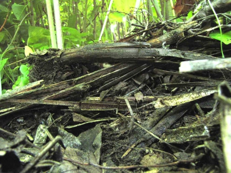
This layer of decomposing knotweed will eventually form soil organic matter in invaded ecosystems.
 Credit: Image courtesy of Clemson University
Clemson University scientists are shedding new light on how invasion by exotic plant species affects the ability of soil to store greenhouse gases. The research could have far-reaching implications for how we manage agricultural land and native ecosystems.

In a paper published in the scientific journal New Phytologist, plant ecologist Nishanth Tharayil and graduate student Mioko Tamura show that invasive plants can accelerate the greenhouse effect by releasing carbon stored in soil into the atmosphere.
Since soil stores more carbon than both the atmosphere and terrestrial vegetation combined, the repercussions for how we manage agricultural land and ecosystems to facilitate the storage of carbon could be dramatic.

In their study, Tamura and Tharayil examined the impact of encroachment of Japanese knotweed and kudzu, two of North America's most widespread invasive plants, on the soil carbon storage in native ecosystems.

They found that kudzu invasion released carbon that was stored in native soils, while the carbon amassed in soils invaded by knotweed is more prone to oxidation and is subsequently lost to the atmosphere.

The key seems to be how plant litter chemistry regulates the soil biological activity that facilitates the buildup, composition and stability of carbon-trapping organic matter in soil.

"Our findings highlight the capacity of invasive plants to effect climate change by destabilizing the carbon pool in soil and shows that invasive plants can have profound influence on our understanding to manage land in a way that mitigates carbon emissions," Tharayil said.

Tharayil estimates that kudzu invasion results in the release of 4.8 metric tons of carbon annually, equal to the amount of carbon stored in 11.8 million acres of U.S. forest.
This is the same amount of carbon emitted annually by consuming 540 million gallons of gasoline or burning 5.1 billion pounds of coal.

"Climate change is causing massive range expansion of many exotic and invasive plant species. As the climate warms, kudzu will continue to invade northern ecosystems, and its impact on carbon emissions will grow," Tharayil said.

The findings provide particular insight into agricultural land-management strategies and suggest that it is the chemistry of plant biomass added to soil rather than the total amount of biomass that has the greatest influence on the ability of soil to harbor stable carbon.

"Our study indicates that incorporating legumes such as beans, peas, soybeans, peanuts and lentils that have a higher proportion of nitrogen in its biomass can accelerate the storage of carbon in soils," Tharayil said.

Thrarayil's lab is following up this research to gain a deeper understanding of soil carbon storage and invasion.

Tharayil leads a laboratory and research team at Clemson that studies how the chemical and biological interactions that take place in the plant-soil interface shape plant communities. He is also the director of Clemson's Multi-User Analytical Laboratory, which provides researchers with access to highly specialized laboratory instruments.

Source: Clemson University

If trees could talk: Forest research network reveals global change effects

In addition to identifying, mapping, measuring and monitoring trees in the CTFS-ForestGEO study plots, researchers describe the relatedness of trees, track flower and seed production, collect insects, survey mammals, quantify carbon stocks and flows within the ecosystem, take soil samples and measure climate variables like rainfall and temperature. The thorough study of these plots provides insights into not only how forests are changing but also why. Credit: Beth King, STRI
Permafrost thaw drives forest loss in Canada, while drought has killed trees in Panama, southern India and Borneo. In the U.S., in Virginia, over-abundant deer eat trees before they reach maturity, while nitrogen pollution has changed soil chemistry in Canada and Panama. Continents apart, these changes have all been documented by the Smithsonian-led Center for Tropical Forest Science-Forest Global Earth Observatory, CTFS-ForestGEO, which released a new report revealing how forests are changing worldwide.

"With 107 collaborators we've published a major overview of what 59 forests in 24 countries, where we monitor nearly 6 million trees teach us about forest responses to global change," said Kristina Anderson-Teixeira, first author of the report and CTFS-ForestGEO and ecosystem ecologist based at the Smithsonian Conservation Biology Institute.

Many of the changes occurring in forests worldwide are attributable to human impacts on climate, atmospheric chemistry, land use and animal populations that are so pervasive as to warrant classification of a new geologic period in Earth's history -- the Anthropocene, the Age of Humans.

Measuring and understanding the effects of all these changes -- collectively termed "global change" -- are easier said than done. Some of the best information about these global-scale changes comes from CTFS-ForestGEO, the only network of standardized forest-monitoring sites that span the globe.

Since the censuses began at the first site on Barro Colorado Island in Panama in 1981, atmospheric carbon dioxide has increased by 16 percent. The forest sites in the network have warmed by an average of over 1 degree F (0.6 degree C) and experienced up to 30 percent changes in precipitation. Landscapes around protected sites experience deforestation.
The plot network now includes forests from Brazil to northern Canada, from Gabon to England and from Papua New Guinea to China.

In addition to identifying, mapping, measuring and monitoring trees, researchers describe the relatedness of trees, track flower and seed production, collect insects, survey mammals, quantify carbon stocks and flows within the ecosystem, take soil samples and measure climate variables like rainfall and temperature. The thorough study of these plots provides insights into not only how forests are changing but also why.

Climate change scenarios predict that most of these sites will face warmer and often drier conditions in the future -- some experiencing novel climates with no modern analogs. Forests are changing more rapidly than expected by chance alone, and shifts in species composition have been associated with environmental change. Biomass increased at many tropical sites across the network.

"It is incredibly rewarding to work with a team of forest scientists from 78 research institutions around the world, including four Smithsonian units" Anderson-Teixeira said. "CTFS-ForestGEO is a pioneer in the kind of collaborative effort it takes to understand how forests worldwide are changing."

"We look forward to using the CTFS-ForestGEO network to continue to understand how and why forests respond to change, and what this means for the climate, biodiversity conservation and human well-being," said Stuart Davies, network director.

Source: Smithsonian Tropical Research Institute

Coexist or perish, new wildfire analysis says: Changing wildfire paradigm from fighting to coexistence

The lightning-sparked Castle Rock Fire burned nearly 50,000 acres in 2007 in the Sawtooth National Forest and adjacent state and private lands surrounding Ketchum, Idaho, in the Smoky Mountains region of the Rocky Mountain range. Credit: Kari Geer, courtesy of the National Interagency Fire Center
Many fire scientists have tried to get Smokey the Bear to hang up his "prevention" motto in favor of tools like thinning and prescribed burns, which can manage the severity of wildfires while allowing them to play their natural role in certain ecosystems.

But a new international research review led by the University of California, Berkeley, says the debate over fuel-reduction techniques is only a small part of a much larger fire problem that will make society increasingly vulnerable to catastrophic losses unless it changes its fundamental approach from fighting fire to coexisting with fire as a natural process.

The paper, "Learning to Coexist with Wildfire," to be published in the Nov. 6 issue of the journal Nature, examines research findings from three continents and from both the natural and social sciences. The authors conclude that government-sponsored firefighting and land-use policies actually encourage development on inherently hazardous landscapes, amplifying human losses over time.

"We don't try to 'fight' earthquakes -- we anticipate them in the way we plan communities, build buildings and prepare for emergencies. We don't think that way about fire, but our review indicates that we should," said lead author Max Moritz, Cooperative Extension specialist in fire at UC Berkeley's College of Natural Resources. "Human losses will only be mitigated when land-use planning takes fire hazards into account in the same manner as other natural hazards, like floods, hurricanes and earthquakes."

The analysis looked at different kinds of natural fires, what drives them in various ecosystems, the ways public response to fire can differ, and the critical interface zones between built communities and natural landscapes. The authors found infinite variations on how these factors can come together.

"It quickly became clear that generic one-size-fits-all solutions to wildfire problems do not exist," Moritz said. "Fuel reduction may be a useful strategy for specific places, like California's dry conifer forests, but when we zoomed out and looked at fire-prone regions throughout the Western United States, Australia and the Mediterranean Basin, we realized that over vast parts of the world, a much more nuanced strategy of planning for coexistence with fire is needed."

Planning for co-existence

If humans choose to live in fire-prone regions, fire must be managed on par with other naturally occurring hazards, the authors argue, and research must seek to understand what factors and outcomes we can and cannot affect.

One common tool is applicable to the vast array of ecological and social science interactions at the critical wildfire/urban interface: more effective land-use planning, along with the regulations that guide it.

The authors recommend prioritizing location-specific approaches to improve development and safety in fire-prone areas, including:

  • Adopting new land-use regulations and zoning guidelines that restrict development in the most fire-prone areas;
  • Updating building codes, such as requiring fire-resistant construction to match local hazard levels and encouraging retrofits to existing ignition-prone homes;
  • Implementing locally appropriate vegetation management strategies around structures and neighborhoods;
  • Evaluating evacuation planning and warning systems, including understanding situations in which mandatory evacuations are or are not effective;
  • Developing household and community plans for how to survive stay-and-defend situations; and
  • Developing better maps of fire hazards, ecosystem services and climate change effects to assess trade-offs between development and hazard.

  • As an example of positive steps, the report cites new fire danger mapping efforts, including an existing fire hazard severity zone map that guides building codes in California. Produced by the state's Department of Forestry and Fire Protection, the current map does not explicitly incorporate locally varying wind patterns, which influence the worst fire-related losses of homes and lives, but future iterations will include these data.

    Fire ecology and climate

    The authors underscore that wildfires are a natural part of many ecosystems and can have a positive long-term influence on the landscape, despite people labeling them as "disasters." They can stimulate vegetation regeneration, promote a diversity of vegetation types, provide habitat for many species and sustain other ecosystem services, such as nutrient cycling.

    Around the world, the numbers, sizes, and intensities of fires vary greatly. In some ecosystems, big, severe wildfires are natural events and more climate-driven -- by drought or high winds -- so fuel reduction is not a very effective tool in these locations. By contrast, many ecosystems that would naturally experience frequent lower-severity fires may respond to vegetation management aimed at both reducing fire hazard to humans and restoring crucial ecosystem processes. But, the authors agree, where fuel reduction is an appropriate goal, it would ideally be achieved by letting wildfires do their job.

    A changing climate will complicate management strategies.

    "How should future fire patterns compare to this historical variability? That's the big question," Moritz said.

    Describing wildfire as "one of the most basic and ongoing natural processes on Earth," the authors call for a paradigm shift in the way society interacts with it, changing to an approach that achieves long-term, sustainable coexistence that benefits the planet's ecosystems on the landscape scale, while minimizing catastrophic losses on the human scale.

    "A different view of wildfire is urgently needed," said Moritz. "We must accept wildfire as a crucial and inevitable natural process on many landscapes. There is no alternative. The path we are on will lead to a deepening of our fire-related problems worldwide, which will only become worse as the climate changes."

    Source: University of California - Berkeley

    Invasive plant wins competition against its native cousin

    This iamge depicts root nodules. Credit: University of Illinois
    Because of its aggressive behavior and its harmful effects, the invasive prairie plant Lespedeza cuneata has been added to several noxious weed lists. Research at the University of Illinois on how soil bacteria interact with the plants' roots to form nodules that fix nitrogen demonstrated that the invasive variety had superior performance when pitted against the native plant variety Lespedeza virginica.

    "We expected Lespedeza cuneata to be a strong competitor when up against its native cousin that's planted primarily for prairie restoration," said U of I microbial ecologist Tony Yannarell. "There are a number of studies showing that L. cuneata grows quickly, is able to shade out its competitors, and has a high rate of nitrogen fixation, which allows it to 'self-fertilize' on unproductive soils."
    Yannarell explained that Lespedeza plants establish a "partnership" with bacteria in the soil to form nodules that fix nitrogen. "We wanted to demonstrate that the partners in this symbiosis matter," he said.
    Because the nitrogen-fixing gene is in the bacteria, the first step in the research was to identify bacteria that have the gene. "We started with isolating a pool of 50 bacteria [from the root nodules of invasive and native Lespedezas] and discovered that some of them weren't traditional nodule-forming bacteria."

    Ultimately, seven bacteria were identified and used in a three-month greenhouse experiment in which various combinations of native and invasive varieties of Lespedeza were grown together in pots. Of the seven, five bacteria were found to benefit the invader and two did not benefit either of the plant varieties.

    "We were hoping to be able to change the degree of competitiveness by using different varieties of Lespedeza by varying the bacteria," Yannarell said. "It turned out that none of the bacteria seemed to be better for the native plant.

    "A really intriguing pattern that we found is that a lot of these strains of bacteria that are good for the invader belong to the Bradyrhizobium genus of bacteria that's been shown in other parts of the world to be good at fixing nitrogen so this was one more confirmation of that information," Yannarell said.

    Yannarell said that this study provides yet another piece in the ecological puzzle.

    The invasive Lespedeza cuneata was intentionally brought into the United States from Japan near the end of the 1800s. At the time, people liked its nitrogen-fixing capacity and soil fertilization. It was intended to be used to stabilize river banks and rehabilitate poor soil. Yannarell said that it has been recommended as wildlife forage, and some think that it has tannins that can act as a deworming treatment for goats. Now, however, it's considered to be a noxious weed that grows in the South and Midwest. It is commonly called silky bush clover.

    Yannarell stressed that there are a lot of different species of Lespedeza that are native to North America and indicative of high-quality prairie. Although Lespedeza cuneata isn't a plant that would be intentionally planted by prairie restorationists, it has been seen in prairie seed mixes.

    "Invasive Lespedeza cuneata and native Lespedeza virginica experience asymmetrical benefits from rhizobial symbionts," was published in Plant and Soil and was co-authored by Lingzi Hu, Ryan R. Busby, and Dick L. Gebhart. The work was supported by a grant from the U.S. Army Engineer Research and Development Center and by the Cooperative State Research, Education and Extension Service, U.S. Department of Agriculture.

    Source: University of Illinois College of Agricultural, Consumer and Environmental Sciences (ACES)

    This image shows a panda eating in China's Wolong Nature Reserve. Pandas habitat choices center around the ready availability of bamboo -- lots of bamboo. Credit: Sue Nichols, Michigan State University

    Walter Dodds, university distinguished professor of biology (pictured), and Allison Veach, doctoral student in biology, are researching grassland streams and the expansion of nearby woody vegetation. They have studied 25 years of data on the Konza Prairie Biological Station and found that increasing fire frequency reduces the rate of woody vegetation expansion. Credit: Image courtesy of Kansas State University
    Two Kansas State University biologists are studying streams to prevent tallgrass prairies from turning into shrublands and forests.

    By looking at 25 years of data on the Konza Prairie Biological Station, Allison Veach, doctoral student in biology, Muncie, Indiana, and Walter Dodds, university distinguished professor of biology, are researching grassland streams and the expansion of nearby woody vegetation, such as trees and shrubs. They have found that burn intervals may predict the rate of woody vegetation expansion along streams.

    Their latest research appears in the peer-reviewed journal PLOS ONE in an article "Fire and Grazing Influences on Rates of Riparian Woody Plant Expansion along Grassland Streams."
    Grasslands in North America and across the globe are rapidly disappearing, Veach said, and woody plants are expanding and converting grasslands into forest ecosystems. This change in environment can affect stream hydrology and biogeochemistry, said Dodds, who has studied streams and watersheds on the Konza prairie for more than 20 years.
    "This is an important issue regionally, because as trees expand into these grassland areas, people who are using grassland for cattle production have less grass for animals, too," Dodds said.

    In their latest research, the biologists studied 25 years of aerial photography on Konza and observed the expansion of trees and shrubs in riparian areas, which include areas within 30 meters of streambeds. The researchers focused on three factors that affect grassland streams: burn intervals; grazers, such as bison; and the historical presence of woody vegetation.

    Their analysis revealed an important finding: Burn intervals predicted the rate of woody vegetation expansion. Burning every one to two years slowed the growth of trees and shrubs, Veach said.

    "Although we can reduce woody expansion by burning more frequently, we can't prevent it from occurring over time," Veach said. "Woody plant encroachment may not be prevented by fire alone."

    The research shows the importance of burning to maintain the tallgrass prairie, Dodds said. While burning can help to slow the expansion of trees and shrubs, additional actions are need to maintain quickly disappearing grassland ecosystems.

    "It's clear from this research that if you don't burn at all, these grassland streams basically are going to switch to forests and will not be grassland streams anymore," Dodds said.
    Dodds and Veach also found that bison do not significantly affect woody vegetation expansion along streams. Previous Konza research has shown that bison do not spend significant time near stream areas, so they may not influence the growth of nearby trees and shrubs, Veach said.

    Woody vegetation also may be expanding in grasslands because of more carbon dioxide in the atmosphere, Dodds said. Grasses and trees compete for carbon dioxide, and grasses are much better at conserving water and efficiently using carbon dioxide. As atmospheric carbon dioxide levels increase, it becomes easier for trees to gather carbon dioxide and gives them a growing advantage over grasses.

    "The tallgrass prairie is almost nonexistent on the globe," Veach said. "In order for us to preserve tallgrass prairie, we need to look at woody encroachment because it has been an issue. Things like no fire or differences in climate change may allow woody plant species to competitively take over grasslands."
    The biologists plan to continue studying water quality and quantity issues at Konza. Konza is an 8,600-acre tallgrass prairie ecological research site jointly owned by the university and The Nature Conservancy.

    Climate change projected to drive species northward

    Coho salmon are among the species anticipated to shift northward with climate change. Credit: NOAA Fisheries
    Anticipated changes in climate will push West Coast marine species from sharks to salmon northward an average of 30 kilometers per decade, shaking up fish communities and shifting fishing grounds, according to a new study published in Progress in Oceanography.

    The study suggests that shifting species will likely move into the habitats of other marine life to the north, especially in the Gulf of Alaska and Bering Sea. Some will simultaneously disappear from areas at the southern end of their ranges, especially off Oregon and California.
    "As the climate warms, the species will follow the conditions they're adapted to," said Richard Brodeur, a NOAA Fisheries senior scientist at the Northwest Fisheries Science Center's Newport Research Station and coauthor of the study. "We're going to see more interactions between species and there will be winners and losers that we cannot foresee."
    The study, led by William Cheung of the University of British Columbia, estimated changes in the distribution of 28 near-surface fish species commonly collected by research surveys in the northeast Pacific Ocean. The researchers used established global climate models to project how the distribution of the fish would shift by 2050 as greenhouse gases warm the atmosphere and, in turn, the ocean surface.

    Brodeur cautioned that like any models, climate models carry uncertainty. While they provide a glimpse of the most likely changes in global climate, they may be less accurate when estimating more fine-scale, local changes.

    "Nothing is certain," he said, "but we think we have a picture of the most likely changes."
    Some species shifts are already being documented as West Coast waters are warming: predatory Humboldt squid from Central and South America have invaded the West Coast of North America in recent years, albacore have shifted to more northerly waters and eulachon have disappeared from warming waters at the southern end of their range.

    "Thinking more broadly, this re-shuffling of marine species across the whole biological community may lead to declines in the beneficial functions of marine and coastal ecosystems," said Tom Okey, a Pew Fellow in Marine Conservation at the University of Victoria and a coauthor of the study. "These declines may occur much more rapidly and in more surprising ways than our expected changes in species alone."

    The study anticipates warm-water species such as thresher sharks and chub mackerel becoming more prominent in the Gulf of Alaska and off British Columbia. Some predators such as sea lions and seabirds, which rear their young in fixed rookeries or colonies, may find the fish they usually prey on moving beyond predators' usual foraging ranges.

    "If their prey moves farther north, they either have to travel farther and expend more energy to get to them, or find something else to eat," Brodeur said. "It's the same thing for fishermen. If it gets warmer, the fish they depend on are going to move up north and that means more travel time and more fuel will be needed to follow them, or else they may need to switch to different target species. It may not happen right away but we are likely to see that kind of a trend."

    El Nino years, when tropical influences temporarily warm the eastern Pacific, offer a preview of what to expect as the climate warms.

    Shifts in marine communities may be most pronounced in high-latitude regions such as the Gulf of Alaska and Bering Sea, which the study identifies as "hotspots" of change. Cold-water species such as salmon and capelin have narrower temperature preferences than warmer water species, making them more sensitive to ocean warming and likely to respond more quickly.

    An intrusion of warm-water species into cooler areas could lead to significant changes in marine communities and ecosystems. The diversity of northern fish communities, now often dominated by a few very prolific species such as walleye pollock, may increase as southern species enter the region, leading to new food web and species interactions.

    Source: NOAA Fisheries West Coast Region

    Impact of climate change on the soil ecosystem

    The Basque Institute for Agricultural Research and Development NEIKER-Tecnalia has had a Microbial Observatory in the Ordesa and Monte Perdido National Nature Reserve (Huesca Pyrenees) since 2011. Its purpose is to evaluate the impact of climate change on the ecosystems of the soil by monitoring its microbial properties over time. Credit: Image courtesy of Basque Research
    The Basque Institute for Agricultural Research and Development NEIKER-Tecnalia has had a Microbial Observatory in the Ordesa and Monte Perdido National Nature Reserve (Huesca Pyrenees) since 2011. Its purpose is to evaluate the impact of climate change on the ecosystems of the soil by monitoring its microbial properties over time. The research areas are located at altitudes of between 1,500 and 2,600 metres, which provides a broad range of different climate conditions and makes it possible to observe how the altitude affects the properties of the soil and the micro-organisms living in it. Preliminary results indicate that microbial properties are highly dependent on the physical and chemical properties of the soil on a small scale and on the environmental conditions existing at the moment when the samples are gathered.

    To conduct this research, NEIKER-Tecnalia is using the most advanced techniques in the matter of molecular biology, which have revolutionised microbial ecology. Specifically, massive sequencing analyses are being carried out right now; they allow a large number of genes to be sequenced and identified within a short space of time. The genetic sequencing of the subterranean biosphere is seeking to gain a better understanding of the structure and function of the microbial communities across the altitude gradient.

    NEIKER-Tecnalia's Microbial Observatory will contribute towards improving the current understanding of the effects of climate change on soil microbial communities and associated ecological processes. The alpine area where it is located is particularly suitable for a climate change observatory. Firstly, it is a remote spot relatively isolated from direct anthropogenic impacts, which means that global effects like climate change can be clearly perceived without the interference of more local environmental factors. Secondly, the altitude gradients that exist in the mountains in turn create clearly marked climate gradients within short distances; in other words, different climate conditions can be found at different altitudes.

    Micro-organisms adapt more quickly than plants and macro-organisms

    Micro-organisms adapt more quickly to changes than plants or other macro-organisms, which means they are ideal bioindicators of the impact of sources of environmental stress on the functioning of ecosystems. It is very important to have a record of the alterations gradually occurring in the soil ecosystem as a result of climate change to be able to more accurately predict what future scenarios are going to be in store. It is important to stress that the soil is our most important resource; it is the basis of the terrestrial ecosystem and 95% of our food comes directly or indirectly from it.

    The role of micro-organisms in relation to the functioning of the soil ecosystem is fundamental. The soil, which has been traditionally regarded as an inanimate item made up of minerals and chemical substances, contains a myriad of micro-organisms that are responsible for many of its vital functions and, consequently, its health. These functions include the decomposition and recycling of nutrients from dead plant and animal tissue, nitrogen fixing, the maintaining of soil structure and the elimination of contaminants.
    It can be predicted that, in the long term, climate change will cause the biota of mountain soil to migrate towards higher altitudes in the quest for the optimum bioclimatic environment. The problem is that this migration has a limit, which is the summit of the mountain, beyond which no migration or escape is possible.

    Source:  Basque Research

    'Family' matters when predicting ecosystems' reaction to global change

    This is a picture of the experimental setup in the greenhouse.
    Credit: Jennifer Schweitzer, co-author and associate professor at UT
    Humans are rapidly changing the look and function of earth's ecosystems, from the increase of greenhouse gases to the unintentional and harmful spread of plants and animals to new environments. A major challenge for ecologists is to understand how and why communities respond to factors that underlie global change.

    A University of Tennessee, Knoxville, study is finding some clues. It shows that just as our family histories dictate what we look like and how we act, plant evolutionary history shapes community responses to interacting agents of global change.

    The research, published in the open-access journal PLOS ONE, may help predict what ecosystems will look like in the future and how they will work.

    "The issues of global change have already begun to jeopardize the natural functioning of ecosystems and important services that we often take for granted like clean air, clean water, food and fiber production," said Rachel Wooliver, lead author and doctoral student in ecology and evolutionary biology. "Our study is the first to experimentally show that plant communities with different evolutionary backgrounds will respond differently to human-caused physical and biological changes."

    In other words, regarding the future effects of global change on ecosystem services and processes humans rely upon, it's all in the family.

    Wooliver and colleagues from UT, the University of Tasmania and Villanova University used eucalypt species native to Tasmania, Australia, to compare plant growth in cultures of all the same species to that of mixtures with native species with an introduced hardwood plantation species. They analyzed plant activity in an ambient environment versus one of increased levels of carbon dioxide and soil nitrogen.

    "We found that only those communities composed of native species within one evolutionary lineage responded significantly to elevated carbon dioxide and nitrogen by taking carbon from the atmosphere and sequestering it into biomass," said co-author John Senior of the University of Tasmania. "Communities from another lineage, on the other hand, showed no response, which suggests that they will play a less crucial role in offsetting the rise of carbon dioxide and global warming."

    This means that evolutionary history will shape which species will effectively sequester carbon and which won't.

    Further, the presence of the nonnative species in these communities influenced productivity differently depending on the evolutionary background of the interacting native species. Thus, family trees can be used to predict how the spread of nonnative species by humans will shape the look and function of ecosystems as global change continues.

    "Overall, this study provides new direction for global change scientists by highlighting that evolutionary history is key to understanding outcomes of plant function and diversity with rapid ecological change," said Wooliver.

    The work is promising to researchers that are trying to figure out if species interactions change how ecosystems are responding to global change, as well as conservation biologists who aim to determine which species might be at higher risk for extinction in the future.

    Source: University of Tennessee
    Environment Now
    Technology+Physics
    Health + Medicine
    Plants + Animals
    SPACE + TIME
    Science + Society

     
    BREAKING NEWS